Surveyor
The best aircraft for special services such as: infrared and classic aerial video and photography, 3D terrain mapping, surveillance, sea and border patrol, power/pipeline monitoring and more...
It has extremely fast cruise speed, excellent camera stability and low noise, superb range and characteristics even in harshest conditions such arctic ice, deserts and tropical regions.
The Pipistrel SURVEYOR Airborne Surveillance program features a special aircraft that is customized with different advanced sensory packages and control systems using the Pipistrel Virus SW 100 as a base airframe with either 35-foot or 50-foot wingspan and then fully customized for your mission requirements.
SPECIAL OFFER: Surveyor just as you need it!
Start with our basic airframe and modify it to suit your particular requirement and payloads. You need it? We can do it!
We offer customised platforms, adapted to your needs! Aircraft suitable for:
-flying at extreme altitudes (up to 30,000 feet),
-with extra-long range (up to 4500 km) and
-with endurance at cruise speed up to 30 hours.
For more information and options please contact info@pipistrel.si
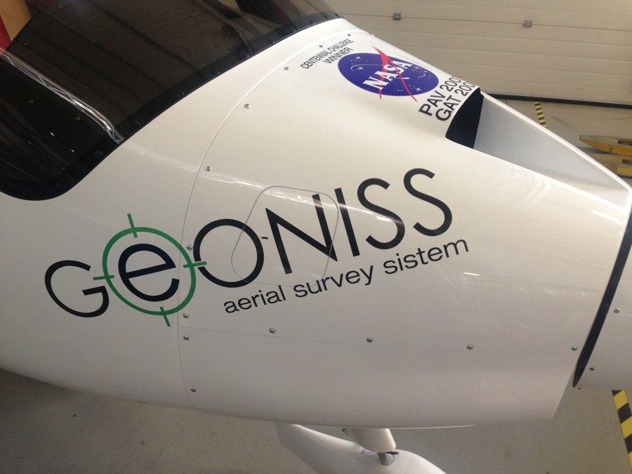
The Pipistrel Virus SW 100 is the winner of two NASA competitions for excellence in aircraft technology, the PAV 2007 Challenge and the GAT 2008 Challenge.
The Surveyor 35 is known for extremely fast cruise speeds and being stable throughout the camera operating speed range.
If longer flights are required the Surveyor 50 is known for its super-efficient operation, extremely low noise footprint and being able to stay airborne for more than 24 hours.
Using advanced composite technologies, the airframe guarantees corrosion-free construction and extreme durability even under the harshest conditions. More than 600 aircraft from these models fly worldwide over deserts, artic ice and tropical regions. The Pipistrel Surveyors’ are truly versatile aircraft with excellent handling characteristics, low purchase and operating costs and high capability sensors.
The Surveyor 35 and Surveyor 50 are available through the Pipistrel Special Operations Program with three payload configurations or
the aircraft can be fully customized and built to suit your specific requirements:
INDEX:
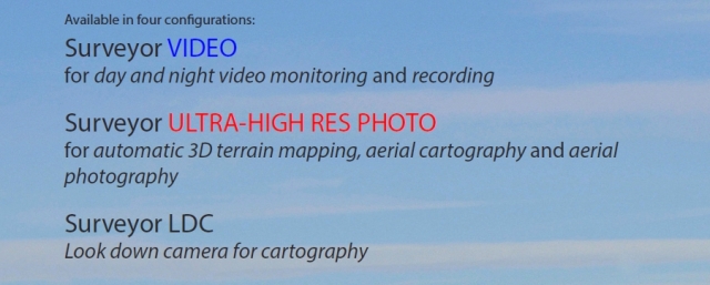
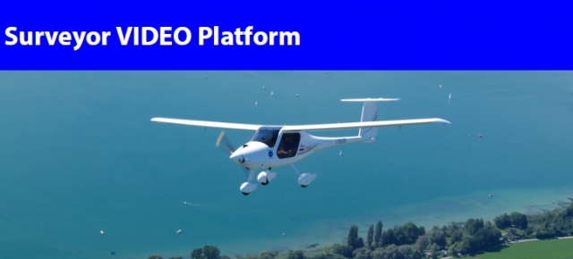
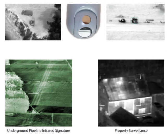
• Surveyor VIDEO Platform - perfect for day and night video recording. The system is equipped with a HD camera with digital zoom and an infrared camera both mounted on a gyrostabilized gimbal. (MORE INFO)
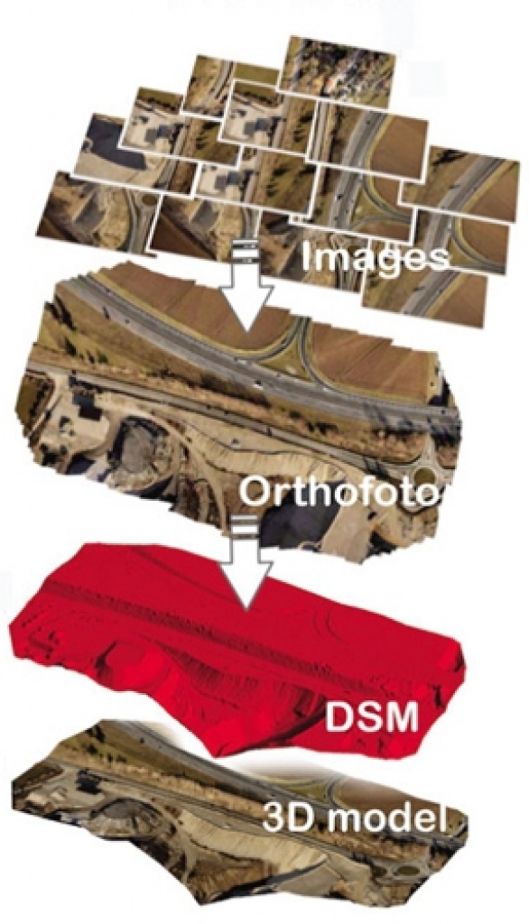
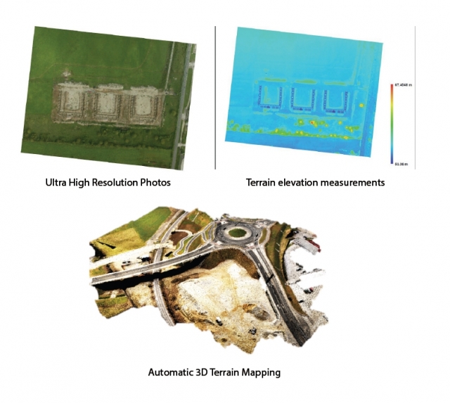
• Surveyor ULTRA HIGH RES PHOTO Platform – superb for 3D terrain mapping and aerial photography. The system is equipped with an ultra-high resolution (36 MP) photographic camera on a gyro-stabilized gimbal (MORE INFO)
• Surveyor LDC - Look down camera for cartography using an automated image tracking and alignment gimbal (MORE INFO)
Model 1
Typical missions include:
• Border Surveillance and Control
• Homeland Security
• Traffic Observation
• Special Events Security
• Surveillance
• Moving target detection and tracking
• Convoy protection
• Fire/ Disaster Management
• Airborne Data Acquisition
• Pollution Control
• Crime prevention
• Wildlife Management
• Forest Management
• Disaster support
• Seaport monitoring
• SAR operation and victim localization
• Maritime/Costal Patrol
• Power/Oil/Pipeline Monitoring
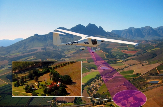
- HD camera (1280 x 720) with integrated zoom (28x) high sensitive sensor
- Gyro-stabilized gimbal with vibration damping mount
- FLIR sensor 640 x 480
- Video digitalization module
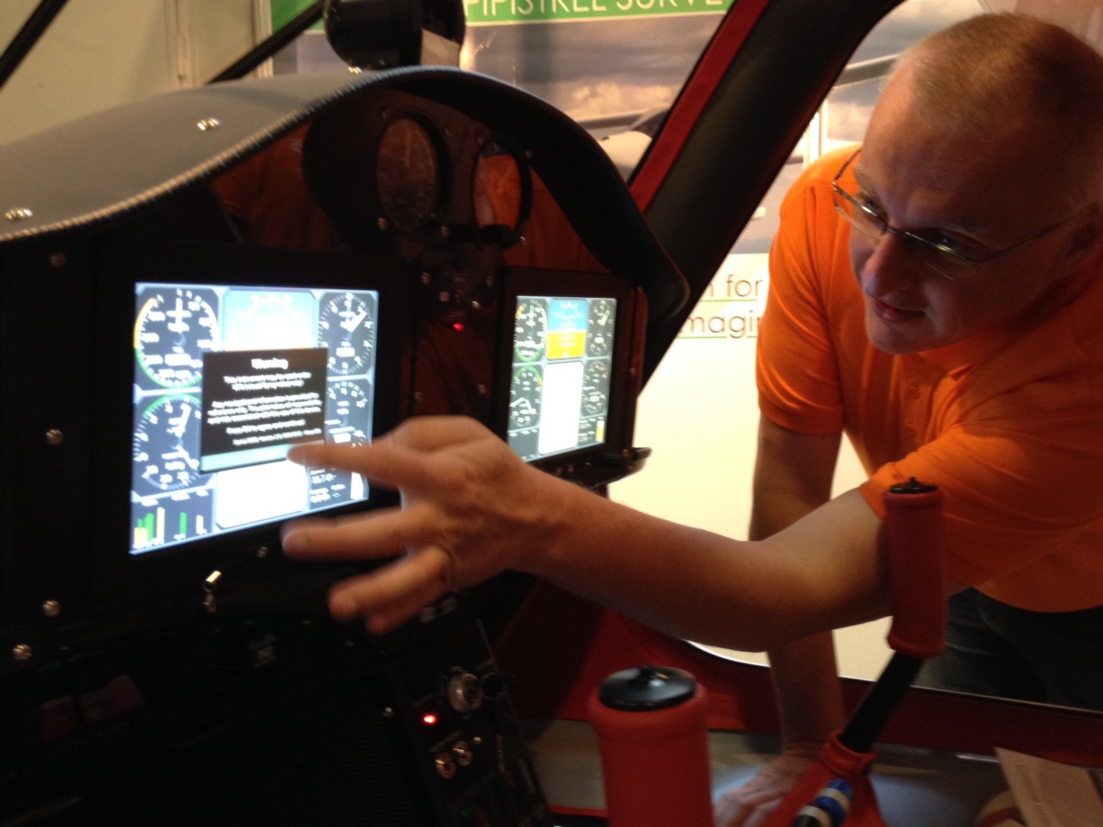
- Rugged computer with 13' touch screen interface, joystick and Windows OS
- 1 TB solid state HD for long endurance video recording – specifically designed for high operating altitudes
- Vision Software
- Stationary target tracking software
- Moving target tracking software (OPTION – not included in basic configuration)
Model 2
Surveyor ULTRA HIGH RES PHOTO Platform
• Real estate mapping for property management
• Forest Management
• Infrastructure Planning
• Post-natural disaster damage assessment
• Automatic 3D map generation
• Power/Oil/Pipeline Mapping
• Infrastructure planning
• Aerial photography
• Advertisement
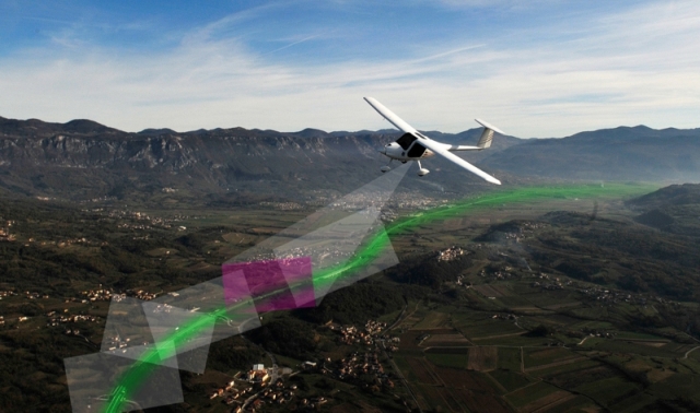
- Suitable for terrain mapping and aerial photography
- Ultra-high resolution camera with 36 MP pixel low noise sensor
- Extra bright lens F2.8 70 mm
- Image acquisition module
- Gyro-stabilized gimbal with vibration damping mount
- Rugged computer with 13' touch screen interface, joystick and Windows OS
- Optional second display
- 1 TB solid state HD designed for high operating altitude
- Vision Software
- Stationary target tracking software
Model 3
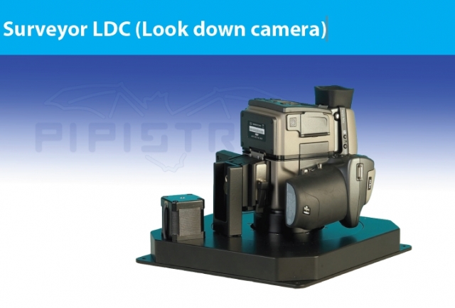
The model features:
• extremely light - 3kg without camera
• works with Nikon, Cannon, Hasselblad cameras (small and medium format cameras)
• tested on Pipistrel Surveyor 35 and Surveyor 50
• home pre-planning of aerial survey routes
• easy transferring navigation data into LDC via SD or USB
• automatic camera triggering above pre-planned spots
• screen confirmation of exposed pictures
• GNSS navigation
• electronic compensation of the camera direction for wind (crab angle)
Very fast development of digital high resolution sensors for small and medium format cameras brought a whole new era into vertical aero photography. Using the Surveyor means ECO attitude - professional results with low noise and gas pollution.
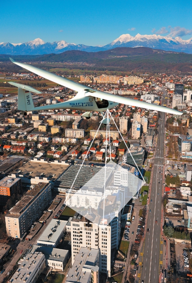
New GNSS and INS navigation systems enable to register precise location of each photograph what make postprocessing faster and more accurate. Our fragile ecosystem is changing fast due to aggressive urbane development and due to natural disasters like forest fires, earthquakes, land and snowslides, floods, hurricane winds. For planning and rebuilding purposes we must do aerial monitoring, documenting changes in natural and urban environment. The LDC is well suited for small and medium areas of aerial survey and for low budget monitoring projects. Perfect for digital orthophoto map production, suited also for photogrametric measurements.

HIGH QUALITY
• precision vertical aero photography
• 24–60 MP digital camera sensors
• metric calibrated lenses and cameras
• resolution from 0.03 m.
LOW COST
The LDC system consists of on-board navigation computer, camera gimble and software for aerial survey.
Supported functions are:
• planning of aerial survey routes and exposition points
• GNSS navigation
• pilot guiding during aerial survey flight
• triggering of the camera
• correcting the camera orientation
Why is the SURVEYOR the perfect choice?
Because the Pipistrel VIRUS SW 100 aircraft combines all these features in one airplane:
• class-leading high cruise speed (264 km/h) to reach the work area in short time
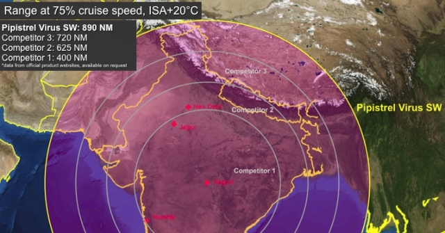
• over 1400 km of range at high cruising speed
• over 7 hours of endurance in loitering/observation mode
• class-leading low fuel consumption (18 liters/hour in high speed operation and 10 liters/
hour in loitering operation)
• superior payload and flexibility - even with full fuel tank, two pilots can fly, carry out
missions
• or train, thanks to dual cockpit controls
• extra-low operating costs combined with high dispatch rate
• extra-low maintenance costs with maintenance packs included in purchase price
• strong undercarriage suitable to operate from unpaved runway
• full aircraft parachute – in case of emergency deployment protects crew and equipment
from impact
• fuselage mount for camera or wing pod mount for advanced sensor packs
The SURVEYOR can do what others can’t:
• climb higher than competitors to avoid aircraft spotting from ground observers or to cross mountains (maximum operating altitude of 5800 meters)
• ultra-long range - get there, work on the mission then return home without refueling
• observe targets at a very low orbiting speed (only 90 km/h), can replace helicopters
• endurance in loitering mode of more than 7 hours!
• high carrying capacity: with full fuel, the payload is 1 crew and 1 pilot, with a sensory pack of up to 150 kg
• take-off and landing on very short (230 meter) runways, also unprepared runways
• available for operation from rough runways using Tundra wheels (available only for tailwheel configuration)
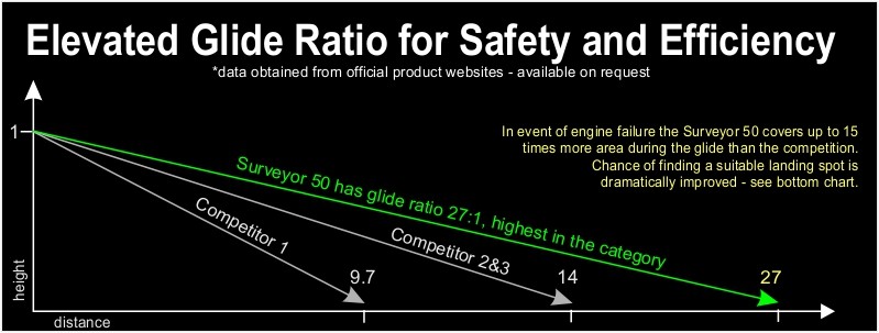
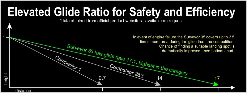
• high glide ratio allows to fly safely the aircraft even in case of engine failure
• aircraft disassembles for road transportation in trailer or truck
• 7-minutes deployment time from trailer to take-off using the special trailer
• special airbrakes allow a fast on-target descent
• wide temperature operating envelope (- 40C to + 55C)
• airframe floats on water surface in case of ditching during maritime surveillance mission
• multi-fuel compatibility, including automotive fuel with up to 10% of ethanol or AVGAS, special fuel is NOT required.
| Description | SURVEYOR (Virus SW 100) |
|---|---|
| ENGINE max power fuel type |
ROTAX 912 ULS or fuel injected 912 iS 100 hp at 5800 RPM Automotive fuel and AVGAS, octanes between 91 and 130, up to 10% ethanol |
| SIZES | |
| wing span length height wing area |
10.71 m 6.5 m 1.85 9.51 m2 |
| WEIGHTS | |
| max take-off weight (MTOW) fuel tanks capacity |
600 kg up to 750 kg 100 l up to 200 l |
| PERFORMANCES | |
| min mission speed for camera work max mission speed for camera work cruising speed (75% power) max. horizontal speed turbulence penetration speed Vb max climb rate take off run take off over 15 m obstacle max altitude fuel consumption at cruise speed endurance at cruise speed (100 l) max operating temperature range distance |
90 km/h 250 km/h 264 km/h 275 km/h 250 km/h 6.6 m/sec 140 m 230 m 5800 m 18.0 l/hour 5.3 h 55 ° C 1415 km (with 100 l of fuel, cruise speed) |
| Pipistrel reserves the right to revise the listed data whenever occasioned by product improvement, government/authority regulations or any other cause. |
|
Technical data - SURVEYOR 50 aircraft
| Description | SURVEYOR (Virus SW 100) |
|---|---|
| ENGINE max power fuel type |
ROTAX 912 80 or 100 hp engines or fuel injected 912 iS 80/100 hp at 5800 RPM Automotive fuel and AVGAS, octanes between 91 and 130, up to 10% ethanol |
| SIZES | |
| wing span length height wing area |
14.97 m 6.5 m 1.82 12.26 m2 |
| WEIGHTS | |
| max take-off weight (MTOW) fuel tanks capacity |
600 kg up to 750 kg 100 l up to 200 l |
| PERFORMANCES | |
| min mission speed for camera work max mission speed for camera work cruising speed (75% power) max. horizontal speed turbulence penetration speed Vb max climb rate take off run take off over 15 m obstacle max altitude fuel consumption at cruise speed endurance at cruise speed (100 l) max operating temperature range distance |
90 km/h 200 km/h 205 km/h 222 km/h 126 km/h 6.6 m/sec 140 m 230 m 5800 m 13.5 l/hour 7.4 h 55 ° C 1518 km (with 100 l of fuel, cruise speed) |
| Pipistrel reserves the right to revise the listed data whenever occasioned by product improvement, government/authority regulations or any other cause. |
|
