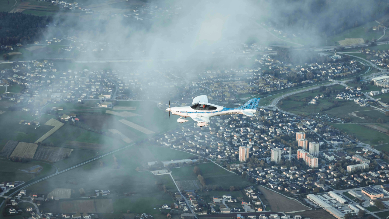
Welcome to A4Aerial - Efficient Aerial Mapping Solutions
At A4Aerial, we revolutionize the way you view the world. Our cutting-edge aerial mapping solutions, powered by Phase One technology and delivered through the unmatched efficiency of Gogetair aircraft, provide unparalleled precision and detail, transforming industries and enhancing decision-making processes across the globe.
Our Technology
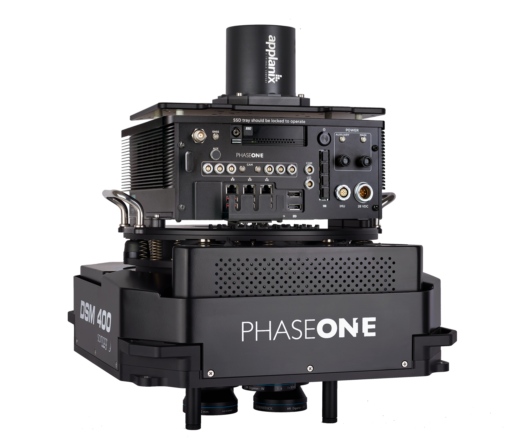
Leveraging the advanced capabilities of Phase One's aerial mapping solutions, we offer unmatched image quality and data accuracy. Phase One’s cameras and sensors are designed for the most demanding photogrammetry applications, ensuring every detail is captured with absolute clarity and precision. Whether it's for urban planning, environmental monitoring, or infrastructure inspection, our technology delivers comprehensive insights that drive progress and innovation.
Our Platform
Our partnership with Gogetair allows us to have the most efficient platform for aerial photography designed to meet the diverse needs of aerial mapping. The Gogetair aircraft are renowned for their reliability, endurance, and cost-efficiency, making them the ideal platform for aerial data acquisition. Their superior performance, combined with our state-of-the-art imaging technology, ensures that no project is too big or too challenging.
Our Solution
A4Aerial's solution stands at the intersection of cutting-edge technology and operational excellence. We offer:- Advanced Imaging Capabilities: Access high-resolution aerial photography, 3D mapping and modeling, LiDAR surveying, and thermal imaging—all from one platform.
- Operational Flexibility: Whether you're conducting large-scale surveys or focused studies, our platform's versatility meets your project's specific requirements.
- Scalability: Our solution grows with your needs, offering scalability from small, targeted projects to extensive, multi-area mapping endeavors.
- Expert Support: Benefit from our dedicated team's expertise in aerial mapping technology and operations, ensuring you maximize your platform's potential.
- Options: We offer the solution with either the Turbo Tech Turbine Engine or the Rotax 916
Elevate Your Aerial Imaging Game
Our platform is designed for organizations and professionals eager to pioneer new horizons in aerial photography. Whether you're looking to enhance your service offering, embark on comprehensive environmental monitoring, or innovate in urban and rural planning, A4Aerial provides the tools and technology to achieve your goals.- Enhanced Project Delivery: Deliver projects with greater efficiency and detail, reducing costs and timelines.
- Unparalleled Precision: Capture every detail with the highest quality imaging technology available on the market.
- Comprehensive Data Analysis: Leverage detailed imagery for in-depth analysis, helping inform decisions and strategies.
Unmatched Cost Efficiency with Gogetair Aircraft Platform
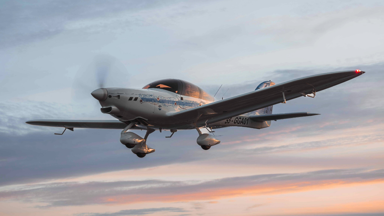
In the world of aerial mapping and photography, efficiency isn't just measured by the quality of imagery or the breadth of data collected; it's also gauged by the operational costs involved. That's where A4Aerial's use of the Gogetair aircraft platform truly sets a new industry standard for cost efficiency, without compromising on the high-end capabilities required for detailed photogrammetry and advanced aerial imaging.
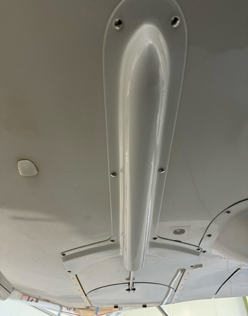
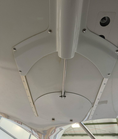
The first aircraft developed specifically for Aerial Photogrammetry is the GOGETAIR G750TP special mission aircraft with a turbine engine and phase one camera integration.- a new, modern and very economical platform for aerial photography. G750 special mission aircraft with a turbine engine and Phase One camera integration.
Integrated into the aircraft with hatch opening when performing the photography
 |
 |
High-End Capability, Economical Operation
Traditionally, deploying high-end photogrammetry solutions meant relying on larger, fuel-intensive aircraft, significantly increasing project costs, both in terms of fuel consumption and aircraft maintenance costs. The Gogetair aircraft platform revolutionizes this approach by offering a solution that accommodates the same advanced photogrammetry technology in a more compact, cost-effective package. This means that our clients can embark on ambitious aerial mapping projects without the burden of exorbitant operational costs.
Remarkable Fuel Efficiency
One of the most striking features of the Gogetair aircraft platform is its exceptional fuel efficiency. Operating at below 20 liters per hour (JetA1 or unleaded petrol), it stands out in the aerial mapping industry for its ability to minimize fuel consumption while maximizing flight duration and coverage. This efficiency does not only lower the environmental impact but also translates into significant cost savings for our clients, making high-end aerial imaging more accessible and sustainable than ever before.
Leveraging Cost Efficiency for Your Advantage
The cost-efficient nature of the Gogetair aircraft platform enables our clients to:
Extend Operational Reach: Conduct longer flights or cover larger areas without the concern of prohibitive fuel costs.
Increase Project Viability: Make previously uneconomical projects feasible, thanks to lower operational expenses.
Reinvest Savings: Redirect funds saved from lower fuel consumption towards other aspects of projects or additional ventures, maximizing overall project value.
Redefining Economic Feasibility in Aerial Imaging
At A4Aerial, we believe in delivering top-tier aerial imaging solutions that are not just advanced but also economically viable. The Gogetair aircraft platform embodies this belief, ensuring that our clients can embark on high-end photogrammetry projects with the assurance of minimal operational costs. Explore the potential of cost-efficient, high-quality aerial mapping with us and elevate your projects beyond conventional limits.
Learn more about Phase One Aerial Mapping Solutions
Learn more about Gogetair aircraft
